
South Florida Birding Locations
South Florida as defined here includes the following counties: Broward, Collier, Hendry, Lee, Miami-Dade, Monroe and Palm Beach. Location descriptions are arranged geographically, beginning with Miami-Dade, Tropical Audubon’s home county. Scroll down to browse the site descriptions. Directions, entrance or parking fees, hours of operation, wheelchair accessibility and map links are provided for each location.

Birders with disabilities who visit a birding location they consider accessible to them are encouraged to submit a site review to birdability.org, which will add the location to their Birdability Map.
Locations listed below in which a Birdability site review has already been submitted will include a link to that site review.
North Miami-Dade County
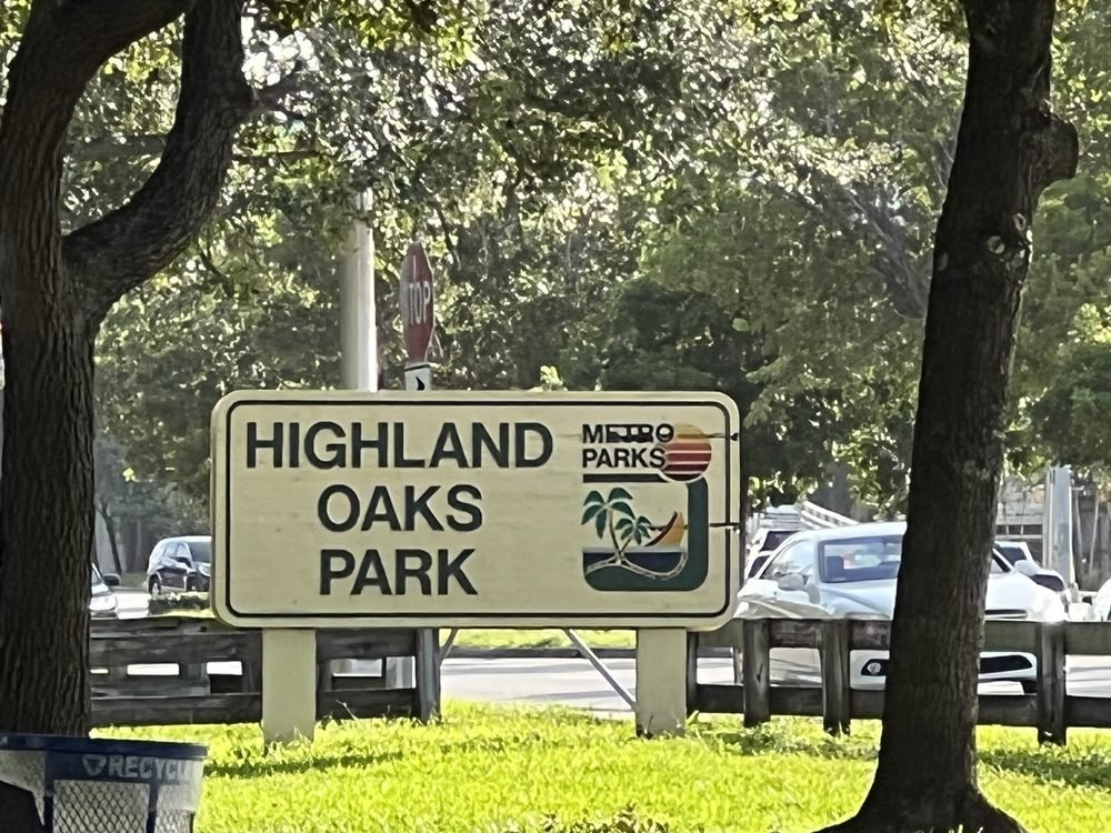
Highlights: Egyptian Goose, Spot-breasted Oriole, migrant and wintering songbirds, especially around the lake at the north end of the park.
Directions: From I-95, exit at Ives Dairy Road (NE 203 Street, Exit 16). Drive east 0.5 miles to the park entrance (no fee, open sunrise to sunset, wheelchair accessible). Restrooms available. Map
Greynolds Park

Highlights: Migrant and wintering songbirds, possible anywhere in the park. Greynolds Park once boasted a large wading bird rookery. The rookery was abandoned during the 1990's, likely due to raccoon predation after alligators were removed from the park.
Directions: From I-95, exit at Miami Gardens Drive (exit 14). Drive east 2.2 miles to the park entrance (fee on weekends, open sunrise to sunset). Restrooms available. Map
Amelia Earhart Park

Highlights: Egyptian Goose, Limpkin, migrant and wintering songbirds, especially around the Bill Graham farm village.
Directions: From the Gratigny Expressway (FL 924), exit at Le Jeune Road (NW 42 Avenue). Drive south on the Douglas/Le Jeune Connector, then turn right onto E 65 Street. Drive west 0.7 miles to the park entrance (fee on weekends, open sunrise to sunset). Restrooms available. Map
Enchanted Forest Elaine Gordon Park & Arch Creek Park

Highlights: These adjacent parks are good for Blue-crowned Parakeets as well as migrant and wintering songbirds, which are possible anywhere in the parks.
Directions: From I-95, exit at NW 135 Street (Exit 10B). Drive east 2.8 miles to the entrance to Enchanted Forest Elaine Gordon Park (no fee, open sunrise to sunset, wheelchair accessible). The entrance to Arch Creek Park is 0.1 miles farther east (no fee, open sunrise to sunset). Restrooms available. Map
Miami Shores

Highlights: Monk, White-winged, Yellow-chevroned, Blue-crowned, Mitred, Red-masked, and White-eyed Parakeets, Chestnut-fronted Macaw, Orange-winged Parrot, Spot-breasted Oriole.
Directions: From I-95, exit at NW 103 Street (Exit 8B). Miami Shores is a residential neighborhood. Bird the neighborhoods east of I-95, between NE 119 Street and NE 95 Street, east to Miami Shores Country Club. Map
Miami Beach

Highlights: Monk, Blue-crowned, Mitred, and White-eyed Parakeets, migrant and wintering gulls, terns, shorebirds and songbirds.
Directions: From I-95, exit at I-195 (Exit 4B). Drive east 4.5 miles over the Julia Tuttle Causeway to Arthur Godfrey Road (W 41 Street). Continue east to Collins Avenue. Directions to specific locations follow:
North Beach: North Beach Oceanside Park, on Collins Avenue at 79 Street (parking fee, open sunrise to sunset). Restrooms available. Map
Mid-Beach: Muss Park (on Chase Avenue, no fee, open sunrise to sunset) and Pine Tree Park (on Pine Tree Drive, no fee, open sunrise to sunset, wheelchair accessible), as well as the neighborhoods between these parks. Both parks are just north of Arthur Godfrey Road. Map
South Beach: Flamingo Park (on 11th Street and Meridian Avenue, no fee, open sunrise to sunset), Lummus Park (on Ocean Drive between 5th and 14th Street, parking fee, open sunrise to sunset) and South Pointe Park and Pier (On Ocean Drive and Inlet Blvd, parking fee, open sunrise to sunset). Restrooms available. Map
Miami Springs

Highlights: Monk, Yellow-chevroned, Blue-crowned, Green, Mitred, Scarlet-fronted, Red-masked, Crimson-fronted and White-eyed Parakeets, Orange-winged Parrot, Gray Kingbird (summer), Spot-breasted Oriole.
Directions: From I-95, exit at the Airport Expressway (FL 112, Exit 4B). Drive west 3.5 miles, exiting on NW 36 Street. Drive 1.5 miles to Curtiss Parkway (NW 57 Avenue) and turn right. From the Palmetto Expressway (FL 826), exit at NW 36 Street. Drive east 2 miles to Curtiss Parkway and turn left. Miami Springs is a residential community north of Miami International Airport. Bird the neighborhood around Fair Haven Nursing Home on Curtiss Parkway (1 mile north of NE 36 Street), as well as the neighborhood around the intersection of Wren Avenue and Apache Street (drive north to a traffic circle and turn right on Westward Drive 1.4 miles to Apache Street and turn right. Drive 0.2 miles to Wren Avenue.) Map
Dolphin Mall

Highlights: Look for water birds in two impoundments on the south side of the mall parking area. These impoundments are the only reliable location in the county for Gray-headed Swamphen. Also look for White-crowned Pigeon, Monk Parakeet, Gray Kingbird (spring and summer), migrant and wintering songbirds.
Directions: From Florida’s Turnpike, exit at NW 12 St. (Exit 27). Drive east 0.2 miles to the mall entrance. Map
Everglades & Francis S. Taylor Wildlife Management Area

Highlights: This area, also known as Water Conservation Area 3B, is on the north side of the Tamiami Canal, which parallels Tamiami Trail along the northern border of Everglades National Park. Snail Kites are most likely during winter and spring, when water levels are low. Also look for large concentrations of wading birds, including Wood Stork and Roseate Spoonbill, when water levels are low. King Rail, Purple Gallinule and Limpkin are possible year-round. Marsh Wren and Swamp Sparrow are here during winter.
Directions: From Florida's Turnpike, exit at Tamiami Trail (US 41, Exit 25). Drive west 3 miles to Krome Avenue (SR 997). Water Conservation Area access points include the S-334 water control structure (1.3 miles west of Krome Avenue), the Valujet Memorial/L 67 Canal area (12 miles west of Krome Avenue) and the Fortymile Bend/L 28 Canal area (24 miles west of Krome Avenue). Levees along the L 67 and L 28 Canals provide hiking/biking access into the interior of this vast area. Map
South Miami-Dade County

Highlights: Magnificent Frigatebird, Reddish Egret, shorebirds, gulls (including Lesser Black-backed Gull), Gray Kingbird (spring and summer), migrant and wintering songbirds.
Directions: From I-95, exit at the Rickenbacker Causeway (Exit 1). Drive east to the causeway toll plaza. Continue east 3 miles to Virginia Beach Drive. Turn left and drive north 0.1 mile to the park entrance (fee Friday to Sunday, open 7:00 AM to sunset). Restrooms available. Map
Crandon Park
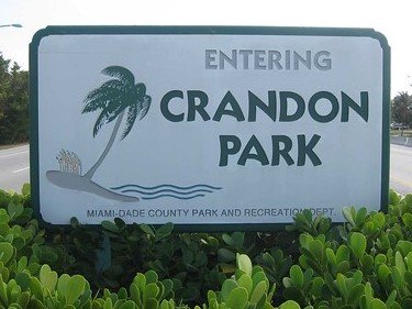
Highlights: Magnificent Frigatebird, Reddish Egret, shorebirds, gulls (including Lesser Black-backed Gull) and terns can be seen at Crandon Beach. Migrant and wintering songbirds, plus Egyptian Goose and Indian Peafowl can be found at Crandon Gardens (wheelchair accessible), at the south end of the park. Gray Kingbird during spring and summer. Mangrove Cuckoo is possible during summer on the boardwalk at Bear Cut Preserve, accessed from the Marjory Stoneman Douglas Nature Center, at the north end of the park. Birdability Site Review
Directions: From I-95, exit at the Rickenbacker Causeway (Exit 1). Drive east to the causeway toll plaza. Continue 4.5 miles to the park entrance (fee, open 7:00 AM until sunset). Restrooms available. Map
Bill Baggs Cape Florida State Park

Highlights: Magnificent Frigatebird, Gray Kingbird (spring and summer), migrant and wintering songbirds, and rarely, Caribbean vagrants. Good birding areas include the bike path, interior nature trail and the youth campground. All can be accessed from the No Name Harbor parking area (first right after the entrance station).
Directions: From I-95, exit at the Rickenbacker Causeway (Exit 1). Drive east to the causeway toll plaza. Continue 6 miles to the park entrance (fee, open 8:00 AM until sunset). Restrooms available. Map
A. D. Barnes Park

Highlights: White-crowned Pigeon, Monk and Yellow-chevroned Parakeets, Gray Kingbird (summer), Spot-breasted Oriole, migrant and wintering songbirds, and rarely, Caribbean vagrants. Birds may be found throughout the park, but especially the grounds of the Sense of Wonder Nature Center. To reach the nature center, turn left after entering the park. The entrance is at the end of this road. If the entrance gate is locked, backtrack to the baseball field parking area. You can enter through a pedestrian gate opposite the field.
Directions: From the Palmetto Expressway (FL 826), exit at Bird Road (SW 40 Street). Drive east 0.5 miles to SW 72 Avenue and turn left to the park entrance (no fee, open 7:00 AM until sunset, wheelchair accessible). Restrooms available. Map
Tropical Park

Highlights: Egyptian Goose, White-crowned Pigeon, Orange-winged Parrot, Monk, Yellow-chevroned and Red-masked Parakeets, Swallow-tailed Kite and Gray Kingbird during spring and summer, migrant and wintering songbirds.
Directions: From the Palmetto Expressway (FL 826), exit at Bird Road (SW 40 Street. Drive west 0.5 miles to the park entrance (no fee, open sunrise to sunset). Restrooms available. Map
Brewer Park (Miller Parrot Roost)

Highlights: Egyptian Goose, White-crowned Pigeon, Blue-and-yellow and Chestnut-fronted Macaw, Orange-winged and Lilac-crowned Parrot, Red-masked, Mitred and Yellow-chevroned Parakeet and Spot-breasted Oriole. Swallow-tailed Kite, Chimney Swift and Gray Kingbird are present during spring and summer.
Directions: From the Palmetto Expressway (FL 826), exit at Miller Drive (SW 56 Street). Drive east 1.5 miles to SW 62 Avenue. Turn right and drive south one block to SW 57 Street. Turn right and drive west 0.1 mile to the parking area (no fee, open sunrise to sunset). Map
Baptist Hospital area
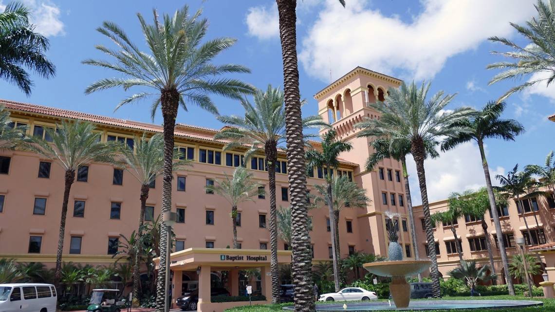
Highlights: Check the hospital grounds, as well as the neighborhood north of the hospital (across North Kendall Drive, between SW 87th and SW 91st Avenues) for White-crowned Pigeon, Monk, Yellow-chevroned and Mitred Parakeets, Red-whiskered Bulbul and Spot-breasted Oriole. During winter, watch for Short-tailed Hawk.
Directions: Baptist Hospital is located on North Kendall Drive (SW 88th Street), 1.5 miles west of US 1, or 1 mile east of the Don Shula Expressway (FL 874). Map
Kendall Indian Hammocks Park

Highlights: White-crowned Pigeon, Monk and Yellow-chevroned Parakeets, Gray Kingbird (summer), Spot-breasted Oriole, migrant and wintering songbirds. Birds may found throughout the park, but especially on trails through the hardwood hammock. The trailhead is opposite the baseball field parking area.
Directions: The entrance (no fee, open 7:00 AM until sunset) is located on SW 107 Avenue, 0.4 miles north of North Kendall Drive (SW 88 Street). Restrooms available. Map
Kendale Lakes Park

Highlights: Migrant and wintering songbirds. Egyptian Goose, Ring-necked Duck (winter) and other water birds are found on or around lakes in the surrounding neighborhoods.
Directions: This tiny park (no fee, open sunrise until sunset), adjacent to Kendale Lakes Elementary School, is located on SW 142 Avenue, about 0.5 miles north of North Kendall Drive (SW 88 Street). A parking area is located on the north side of the school. Another parking area is accessed from SW 145 Avenue. Restrooms available. Map
Matheson Hammock Park

Highlights: White-crowned Pigeon, Yellow-chevroned and Red-masked Parakeets, Orange-winged Parrot, Chestnut-fronted and Blue-and-yellow Macaw, migrant and wintering shorebirds and songbirds. Check the picnic area, the area around the beach and marina as well as the nature trail on the west side of Old Cutler Road.
Directions: From US 1, drive east 2.4 miles on North Kendall Drive (SW 88 Street) to Old Cutler Road. Turn right and drive south 0.6 miles to the park entrance (fee for beach area, open sunrise to sunset). Restrooms available. Map
Fairchild Tropical Botanic Gardens

Highlights: Egyptian Goose, White-crowned Pigeon, Yellow-chevroned Parakeet, Orange-winged Parrot, Chestnut-fronted and Blue-and-yellow Macaw, migrant and wintering songbirds.
Directions: From US 1, drive east 2.4 miles on North Kendall Drive (SW 88 Street) to Old Cutler Road. Turn right and drive south 0.8 miles to the visitor entrance (fee, open 10 AM to 5 PM). Restrooms available. Map
Pine Woods Park
Highlights: Look for Red-whiskered Bulbul, Spot-breasted Oriole and Scaly-breasted Munia in tall grasses and trees under the power lines. Monk Parakeets nest on the power poles.
Directions: From the Don Shula Expressway (CR 874), exit at Killian Parkway. Drive east 0.4 miles to SW 102 Avenue. Turn right and drive south to SW 132 Street. The "park" is the power line right-of-way east of SW 102 Avenue. Map
Kendall-Tamiami Executive Airport

Highlights: Burrowing Owl (look for burrows along airport roads, marked by orange cones). In winter, look for Scissor-tailed Flycatcher on the perimeter fence at the back of the airport, accessed from SW 136 Street.
Directions: The airport entrance is on SW 137 Avenue at SW 128 Street, 2.5 miles south of North Kendall Drive (SW 88 Street). Birders must now check in with the airport’s Operations Office (305-868-1700) before birding at this location. Map
Larry and Penny Thompson Park

Highlights: This park, along with Zoo Miami, are within the Richmond Pinelands, the largest remaining tract of endangered pine rockland habitat outside of Everglades National Park. Look for Brown Thrasher, Eastern Towhee, Scaly-breasted Munia, migrant and wintering songbirds.
Directions: From Florida’s Turnpike, exit at Eureka Drive (SW 184 Street, Exit 13). Drive west 1.4 miles to the park entrance (no fee, open sunrise to sunset). Restrooms available. Map
C-357 Sparrow Fields (Rocky Glades Public Small Game Hunting Area)

Highlights: A variety of sparrows can be found in brushy areas during winter, including Savannah, Grasshopper, Swamp, White-crowned, Lincoln’s and Clay-colored. Eastern Towhee is resident. Wintering waterfowl and large numbers of wading birds are attracted to water storage impoundments. White-tailed Kite and Bald Eagle are possible year-round.
Directions: From Krome Avenue (SW 177 Avenue), drive west 4.0 miles on SW 168 Street (Richmond Drive) to series of yellow gates at the border with Everglades National Park. Walk south along a berm to access the sparrow fields. The area west of the yellow gates is currently closed to vehicular traffic. Map
Coral Reef Park

Highlights: Egyptian Goose, Limpkin, Blue-and-yellow and Chestnut-fronted Macaw, Mitred, Red-masked, White-eyed and Yellow-chevroned Parakeets, migrant and wintering songbirds.
Directions: From Florida’s Turnpike, exit at Coral Reef Drive (SW 152 Street, Exit 18). Drive east 4 miles to the park entrance (no fee, open sunrise to sunset). Restrooms available. Map
Deering Estate at Cutler

Highlights: White-crowned Pigeon have been found on the estate grounds throughout the year. Look for migrant and wintering songbirds, plus Mangrove Cuckoo, Gray Kingbird and Black-whiskered Vireo during spring or summer. Scaly-breasted Munias regularly visit seed feeders at the visitor center. Wintering ducks, loons and grebes are possible in the bay, best viewed from the People's Dock, accessed from a paved path that begins at the back side of the visitor center.
Directions: The park entrance and visitor center (fee, open 10:00 AM to 5:00 PM) is on SW 168 Street, just east of Old Cutler Road. Birding on the estate grounds is allowed only during walks led by park staff. Restrooms available. Map
Bill Sadowski Park

Highlights: Indian Peafowl, White-crowned Pigeon, Painted Bunting, Spot-breasted Oriole, migrant and wintering songbirds.
Directions: This small park (no fee, open sunrise to sunset) is located at SW 176 Street and 79th Avenue, 0.5 mile west of Old Cutler Road. Map
Cutler Wetlands
Highlights: Wintering ducks, as well as migrant and wintering shorebirds and gulls congregate here, depending upon water levels.
Directions: This small mitigation marsh is located at the intersection of SW 97 Avenue and SW 224 Street. From Old Cutler Road, drive east 0.5 miles on SW 224 Street. From SW 248 Street, drive north 1.5 miles on SW 97 Avenue. Find a place to park along SW 224 Street. Map
Black Point Park

Highlights: This park provides access to a jetty within Biscayne National Park. Mangrove Cuckoo is possible year-round. The Cuban race of Yellow Warbler (Cuban Golden Warbler) is possible during summer in mangroves around the periphery of the park. Shorebirds, gulls and terns can be found year-round at the end of the jetty. Ducks congregate offshore during winter.
Directions: From Florida's Turnpike, exit at SW 112 Avenue (Exit 9). Turn right on SW 248 Street and drive east (bearing left when the road forks) for 2.2 miles. Turn left and drive another 0.5 mile to a stop sign. Turn right into the parking area. (no fee, open sunrise to sunset, wheelchair accessible). Restrooms available. Map
Dump Marsh
Highlights: Ducks, gulls and American White Pelican during winter. A Smooth-billed Ani was present during the winter of 2017-18. Wading birds are present year-round, depending upon water levels.
Directions: Dump Marsh is a wetland across from the South Dade landfill, known to locals as “Mt. Trashmore”. From Florida's Turnpike, exit at SW 112 Avenue (Exit 9). Turn right on SW 248 Street and drive east (bearing left when the road forks) to SW 97 Avenue. Continue east on the unpaved road on the south side of the canal. Park along the fence before a bridge and locked gate. Turn right beyond the gate and walk south to reach the wetlands. Map
Castellow Hammock Park

Highlights: Wintering hummingbirds in the butterfly garden (including Rufous and Buff-bellied in recent years), migrant and wintering songbirds in the hammock.
Directions: From Florida's Turnpike, exit at SW 216 Street (exit 11). Drive west 5.4 miles to SW 162 Avenue. Turn left and drive south 0.4 miles to the park entrance (no fee, open 8:00AM to 5:00PM). Restrooms available. Map
Portofino Plaza Swallow Colony

Highlights: Caribbean race Cave Swallows nest under a Florida Turnpike bridge that crosses a canal behind the Portofino Plaza shopping center.
Directions: From Florida’s Turnpike, exit at Campbell Drive (Exit 2). Drive east o.1 mile to the Portofino Plaza shopping center on the south side of Campbell Drive. Drive to the canal along south side of the shopping plaza. Map
Homestead Racetrack Fields

Highlights: Migrant shorebirds congregate in fallow fields in this area, especially when puddles form after rainstorms. The fields are also attractive to waterfowl, including Black-bellied Whistling Duck and Mottled Duck, swallows, including Cave Swallow and cowbirds, including Shiny and Bronzed Cowbird.
Directions: From Florida's Turnpike, exit at Speedway Boulevard (SW 137 Avenue, exit 6). Turn left and drive south 3 miles to North Canal Drive (SW 328 Street). Turn left and drive east 0.5 miles to SW 132 Avenue, an unpaved farm road. Several unpaved farm roads cross the fields and provide access to this area. Map
Biscayne National Park

Highlights: On the jetty beyond the Dante Fascell Visitor Center, shorebirds, gulls and terns are likely year-round. Migrant songbirds and Caribbean vagrants are possible on Elliot Key, accessible only by boat.
Directions: From Florida's Turnpike, exit at Speedway Boulevard (SW 137 Avenue, exit 6). Turn left and drive south 3 miles to North Canal Drive (SW 328 Street). Turn left and drive east 4 miles to the park entrance (no fee, open 7:00 AM to 5:30 PM, wheelchair accessible). Restrooms available. Map
Lucky Hammock and the Annex (Frog Pond WMA/Southern Glades WEA)

Highlights: White-crowned Pigeon can be seen year-round in hammock areas along Aerojet Road. Sandhill Crane and White-tailed Kite can sometimes be found in surrounding fields east to the C-111 Canal or west to the L-31W Canal. Migrant and wintering songbirds, including Brown-crested Flycatcher, Yellow-breasted Chat, Painted Bunting and various sparrows can be found in hammock and brushy areas. Migrant Alder Flycatchers and occasionally Willow Flycatchers have been found here during late summer. Also check fallow agricultural fields east of the C-111 Canal during this season for Upland Sandpiper and other shorebirds. Scissor-tailed Flycatchers usually winter here, often joined by Western Kingbirds and almost annually, a Tropical Kingbird.
Directions: From the intersection of Florida's Turnpike and US 1 in Florida City, turn right on Palm Drive (SW 344 Street) and drive west 1.6 miles. Turn left on SW 192 Avenue and drive south 2.0 miles. Turn right on SW 376 Street (FL 9336) and drive west 4.5 miles to Aerojet Road (SW 232 Avenue, now gated). Park on the grassy area near the gate. Lucky Hammock, in Frog Pond Wildlife Management Area, is a small hardwood hammock surrounded by brushy fields, located 0.3 miles south of the gate on the west side of Aerojet Road. The Annex, a brushy area planted in native trees within Southern Glades Wildlife and Environmental Area, begins at a second gate farther south on Aerojet Road. Map
Everglades National Park

Highlights: Least Bittern, Reddish Egret, Roseate Spoonbill, Wood Stork, Swallow-tailed Kite, Snail Kite, Bald Eagle, King Rail, Purple Gallinule, Limpkin, White-crowned Pigeon and Brown-headed Nuthatch may be found year-round. During spring and summer, look for Mangrove Cuckoo, Chuck-will's Widow, Gray Kingbird, Black-whiskered Vireo and the Cape Sable race of Seaside Sparrow. During winter, watch for Short-tailed Hawk, Scissor-tailed Flycatcher, Painted Bunting and Nelson’s and Saltmarsh Sparrows.
Directions: From the intersection of Florida's Turnpike and US 1 in Florida City, turn right on Palm Drive (SW 344 Street) and drive west 1.6 miles. Turn left on SW 197 Avenue and drive south 2 miles. Turn right on SW 392 Street (FL 9336) and drive west 5 miles to the park entrance (fee, open 24 hours). Map
Recommended stops along the main park road, from the Ernest Coe Visitor Center in Miami-Dade County to Flamingo in Monroe County:

Highlights: During spring and summer, look for Swallow-tailed Kite overhead and listen for Chuck-will’s-widow after sunset/before sunrise. Look for wintering songbirds in the parking area and around the visitor center.
Directions: The visitor center is on the right side of the main park road just after entering the park but before reaching the fee station. Restrooms available. Map
Royal Palm Visitor Center

Highlights: Wood Stork and other wading birds, Least Bittern, King Rail and Purple Gallinule may be found in sawgrass prairie along Anhinga Trail (wheelchair accessible). Migrant and wintering songbirds may be found in a tropical hardwood hammock accessed via the Gumbo Limbo Trail (wheelchair accessible). Overhead, look for Swallow-tailed Kite during spring and summer, and Short-tailed Hawk during winter. These two raptors may be seen just about anywhere in the park during the appropriate season. Birdability Site Review
Directions: The turnoff is 2 miles from Ernest Coe Visitor Center. Turn left and drive 1.8 miles to the parking area. Restrooms available. Map
Research Road

Highlights: This 6-mile road passes through pine rockland habitat, as well as an area of abandoned agricultural fields known as the Hole-in-the Donut. This area is being restored to wetland habitat that attracts a variety of wading birds including Wood Stork and Roseate Spoonbill, migrant shorebirds and wintering waterfowl. The road also provides access to the Daniel Beard and Dr. Bill Robertson Research Centers. Look for reintroduced Brown-headed Nuthatch, as well as other pineland species in areas of pine rockland along the road or on trails beginning at Gates 2, 2A and 2B. Scan for White-tailed Kite in restored wetlands beyond the research centers.
The end of the road contains one of the best-preserved relics of the Cold War in Florida—a Nike Hercules Missile Site listed on the National Register of Historic Places. In an effort to better protect the missile site, a gate closes off the access road beyond the research center. Except when the Missile Site is open for tours, access beyond this gate is limited to travel by foot or bicycle.
Directions: The turnoff is on Royal Palm Hammock Road, 1 mile from the main park road. In 0.4 miles, turn right at the stop sign onto Research Road. To access the Hidden Lake area, including trails at Gates 13 and 15, continue straight at the stop sign. This area also has restored wetlands that attract birds when flooded. Map
Long Pine Key

Highlights: Look for pineland species, including Northern Bobwhite and reintroduced Brown-headed Nuthatch, in the picnic area and adjacent campground. Listen for Chuck-will’s-widow after sunset/before sunrise during spring and summer. The Long Pine Key Trail is a 22-mile system of interconnecting trails through pine rocklands and tropical hardwood hammocks, the latter good for migrant and wintering songbirds.
Directions: The turnoff is 2.2 miles past Royal Palm Hammock Road. Turn left and drive 1.5 mile to the picnic area. Restrooms available. Map

Highlights: A 0.4-mile paved trail through pine rockland habitat (wheelchair accessible). Look for Swallow-tailed Kite (spring/summer), reintroduced Brown-headed Nuthatch and other pineland species, migrant and wintering songbirds.
Directions: The parking area is 2 miles past the Long Pine Key turnoff. Map

Highlights: Look for Barred Owls and wading birds in cypress habitat along the entrance road. From the observation platform (wheelchair accessible), scan for Snail Kite, Limpkin and other wading birds. Birdability Site Review
Directions: The turnoff is 6 miles past the Pineland Trail. Turn right and drive 1.2 miles to the parking area. Map

Highlights: Look for Barred Owls and migrant and wintering songbirds along the boardwalk (wheelchair accessible). The Cape Sable race of Seaside Sparrow may be found, especially during spring, along the main park road about 0.5 miles past the Mahogany Hammock turnoff. Birdability Site Review
Directions: The turnoff is 7 miles past Pa-hay-okee Road. Turn right and drive 1.7 miles to the parking area. Map
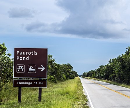
Highlights: Large numbers of wading birds, including Roseate Spoonbill, roost on the opposite side of the pond. Wood Storks nest here. Watch overhead during spring and summer for Swallow-tailed Kite.
Directions: The turnoff is 4.4 miles past Mahogany Hammock Road. Map


Highlights: Look for wintering waterfowl on the lake and migrant and wintering songbirds along the boardwalk (wheelchair accessible) through mangrove forest. Mangrove Cuckoo is occasionally found here. Birdability Site Review
Directions: The turnoff is 4.5 miles past Nine Mile Pond. Restrooms available. Map

Highlights: This 1.6-mile trail through mangrove forest leads to Snake Bight, an indentation in the shoreline of Florida Bay. Look for White-crowned Pigeon, Mangrove Cuckoo, Barred Owl, Painted Bunting and migrant and wintering songbirds along this trail. The boardwalk at the end of the trail provides the best chance to see American Flamingo from land (though sightings have been scarce since the hurricanes of 2005). Wading birds and shorebirds are sometimes abundant at this location. Time your visit for high tide and prepare for mosquitoes.
Directions: The trailhead is 1.7 miles past West Lake. Map

Highlights: Ducks, pelicans and wading birds, including Wood Stork and Roseate Spoonbill, sometimes congregate and feed here when water levels drop during late winter.
Directions: The pond is 1.5 miles past Snake Bight Trail. Map

Highlights: Look for White-crowned Pigeon, Mangrove Cuckoo, Black-whiskered Vireo (spring and summer) and migrant and wintering songbirds as you hike this two-mile trail through tropical hardwood hammock and mangrove forest.
Directions: The turnoff is 3.4 miles past Mrazek Pond, just past Buttonwood Canal and just before entering Flamingo. Turn right and drive Buttonwood Canal Road to the trailhead parking area. Map
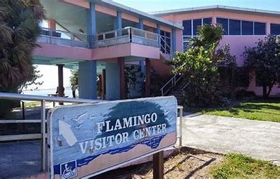
Flamingo
Highlights: Pelicans, shorebirds, gulls and terns congregate at low tide on a sandbar offshore from the Guy Bradley Visitor Center (wheelchair accessible). Also look for Reddish Egret, Roseate Spoonbill and other wading birds offshore. The one-mile Guy Bradley Trail (wheelchair accessible) begins at the far end of the visitor center parking area and passes through maritime hammock and mangrove habitat, ending at an amphitheater adjacent to the Flamingo campground. Shorebirds often congregate along the shore in the amphitheater area at high tide. Watch overhead for Bald Eagle year-round and Swallow-tailed Kite during spring and summer. Search for Shiny Cowbirds among flocks of Brown-headed Cowbirds, feeding on lawns surrounding the visitor center parking area or around the amphitheater. Gray Kingbird and Black-whiskered Vireo can also be found in this area during the summer months.
Many of these same birds may also be seen on boat tours to Whitewater Bay and Florida Bay. Boats depart from the Flamingo marina.
Directions: At the end of the main park road, just beyond Buttonwood Canal bridge. Restrooms available. Map

Highlights: This former freshwater pond was heavily damaged by hurricanes in 2005 and is now a brackish water pond. Look for wintering ducks and shorebirds on the pond, and Bald Eagle, Roseate Spoonbill and Scissor-tailed Flycatcher, Painted Bunting and other wintering songbirds in surrounding vegetation.
Directions: Parking area is 0.8 mile past the Flamingo Visitor Center. Map

Highlights: Clapper Rail and Roseate Spoonbill may be present year-round; Black Rail (rare) and Nelson's and Saltmarsh Sparrows may be present in coastal prairie habitat along the first mile of the trail during winter.
Directions: The trailhead is located at the west end of Loop B of the Flamingo Campground. Map
There are two other entry points into Everglades National Park: Shark Valley on Tamiami Trail and Gulf Coast Visitor Center in Everglades City.
Shark Valley

Highlights: An entrance on Tamiami Trail (US 41), along the northern border of the park, provides access to Shark Valley. A loop road (15 mile round-trip) leads to an observation tower overlooking the surrounding sawgrass marsh. The observation tower can be accessed via regularly scheduled tram tours, by bicycle (rentals available) or by foot. In the canal along the west side of the loop road, look for a variety of wading birds, King Rail and Purple Gallinule. Roseate Spoonbill and other waders may be seen anywhere along the loop road. Birdability Site Review
Directions: From Florida's Turnpike, exit at Tamiami Trail (US 41, exit 25). Drive west 23.5 miles to the entrance (fee, open 8:30 AM to 5:00 PM, wheelchair accessible). Restrooms available. Map
Gulf Coast Visitor Center, Everglades City

Highlights: Everglades City, in Collier County, is the gateway to the Ten Thousand Islands area of Everglades National Park, which is accessible only by boat. The Gulf Coast Visitor Center is currently closed due to damage caused by recent hurricanes, but boat tours and canoe/kayak rentals are still available. Reservations can be made online. Look for Mangrove Cuckoo, American Oystercatcher, Wilson’s Plover, migrant and wintering shorebirds, gulls and terns, American White Pelican, Wood Stork, Magnificent Frigatebird, Reddish Egret, Roseate Spoonbill and Bald Eagle.
Directions: From I-75 (Alligator Alley), exit at FL 29 (Exit 80). Drive south 16.5 miles to Tamiami Trail (US 41). Continue south 4.7 miles to the visitor center (currently closed). Boat tours (fee) depart from the visitor center area. Restrooms available. Map
The Florida Keys

The Overseas Highway (US 1) leads from Florida City in Miami-Dade County to Key West in Monroe County. Locations can be found using the highway's mile marker (MM) system. Card Sound Road provides direct access from Florida City to North Key Largo. Map
Card Sound Bridge

Highlights: White-crowned Pigeon and Cuban Golden Warbler may be found in mangroves or on wires in the area around the bridge toll station, on the mainland side of the bridge. Gray Kingbird and Black-whiskered Vireo are here during summer. Clapper Rail, Reddish Egret, Roseate Spoonbill and other wading birds may be seen at low tide on mudflats along Card Sound Road in Crocodile National Wildlife Refuge, on the Key Largo side of the bridge.
Directions: From the intersection of Florida's Turnpike and US 1 in Florida City, drive south 1 mile on US 1 to Card Sound Road. Turn left and drive 12.5 miles to the bridge toll station. Map
Dagny Johnson Key Largo Hammock Botanical State Site

Highlights: White-crowned Pigeon, Mangrove Cuckoo, Gray Kingbird, Black-whiskered Vireo, migrant songbirds and, rarely, Caribbean vagrants, may be found on the paved path or unpaved nature trail in the botanical site, or along Loquat Road, just south of the parking area.
Directions: From the intersection of Florida's Turnpike and US 1 in Florida City, drive south 21 miles to CR 905. Turn left and drive north 0.4 miles to the parking area (fee, open 8:00 AM until sunset, wheelchair accessible). Restrooms available. Map
John Pennekamp Coral Reef State Park

Highlights: White-crowned Pigeon, Mangrove Cuckoo, Gray Kingbird, Black-whiskered Vireo, migrant songbirds and Caribbean vagrants are all possible within the park. Brown Booby may be seen at Molasses Reef Light, a stop on the park's glass-bottom boat tour.
Directions: The entrance (fee, open 8:00 AM to sunset) is on US 1 at MM 102.5. Restrooms available. Map
Florida Keys Wild Bird Center
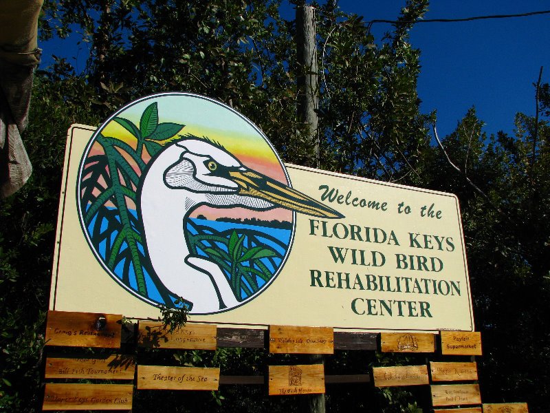
Highlights: Roseate Spoonbill and other wading birds in lagoons accessed via a boardwalk system, migrant songbirds along a nature trail.
Directions: The entrance (donation requested, open 24 hours) is on US 1 at MM 93.6. Map
Windley Key Fossil Reef Geological State Park

Highlights: White-crowned Pigeon, Gray Kingbird, Black-whiskered Vireo, migrant songbirds and Caribbean vagrants are all possible in the tropical hardwood hammocks within the park. An extensive trail system provides access.
Directions: The entrance (fee, open 8:00 AM to 5:00 PM, closed Tuesdays and Wednesdays) is on US 1 at MM 85.3. Restrooms available. Map
Long Key State Park

Highlights: Magnificent Frigatebird, Reddish Egret, Black-whiskered Vireo and migrant raptors, shorebirds and songbirds, plus Caribbean vagrants are all possible within the park. A boardwalk and loop trail provide access.
Directions: The entrance (fee, open 8:00 AM to sunset) is on US 1 at MM 68. Restrooms available. Map
Curry Hammock State Park

Highlights: Home each fall to the Florida Keys Hawkwatch. During fall migration, a variety of raptors, including large numbers of Swallow-tailed Kites (Aug) and Peregrine Falcons (Sept/Oct), pass over the park. Also look for Magnificent Frigatebird, Reddish Egret, and migrant shorebirds and songbirds.
Directions: The entrance (fee, open 8:00 AM to sunset) is on US 1 at MM 56.5. Restrooms available. Map
Marathon

Highlights: During spring and summer, Antillean Nighthawks can be seen or heard at dusk over the airport. During migration, shorebirds often congregate in puddles at the west end of the airport. Search for migrant songbirds on trails at Crane Point Hammock Museum and Nature Trail. Burrowing Owls can sometimes be found at Sombrero Beach Golf Course. Roseate and Least Terns sometimes nest on rooftops during summer at Marathon Government Center.
Directions: Marathon Airport is on US 1 at MM 53. Crane Point Hammock Museum and Nature Trail is at MM 50. Sombrero Beach Golf Course is on Sombrero Boulevard, across from the museum. Marathon Government Center is at MM 48.5. Map
Bahia Honda State Park

Highlights: Magnificent Frigatebird, Reddish Egret, White-crowned Pigeon, Black-whiskered Vireo, migrant songbirds and Caribbean vagrants.
Directions: The entrance (fee, open 8:00 AM to sunset) is on US 1 at MM 37. Restrooms available. Map
National Key Deer Refuge

Highlights: Short-tailed Hawk, Antillean Nighthawk, migrant songbirds and Key Deer.
Directions: From US 1 on Big Pine Key, exit at Wilder Road (MM 30.5), then immediately bear left onto Key Deer Boulevard. Drive north 2.8 miles to the Blue Hole parking area (no fee, open 24 hours). Continue another 0.3 miles to the Frederick Manillo Nature Trail. Map
Boca Chica Beach

Highlights: This beach is adjacent to Key West Naval Air Station. Do not trespass on air station property and avoid pointing optics in the direction of the runways. Look for White-crowned Pigeon, Antillean Nighthawk (at dusk during spring/summer), Clapper Rail, Wilson’s Plover, migrant and wintering shorebirds, Least Tern (spring/summer), Magnificent Frigatebird, Reddish Egret, Gray Kingbird (spring/summer) and migrant songbirds.
Directions: From US 1 on Big Coppitt Key, exit at Boca Chica Road (CR 941, MM 10.7). Drive 3 miles to the beach (no fee, open sunrise to sunset). Map
Key West Tropical Forest and Botanical Garden

Highlights: The gardens provide habitat for White-crowned Pigeon, Gray Kingbird, Black-whiskered Vireo, migrant songbirds and Caribbean vagrants. Scissor-tailed Flycatchers are often seen in the area during winter. During spring and summer, Antillean Nighthawks may be seen at dusk over Florida Keys Community College, also on College Road, 0.7 miles from the botanical garden. Birdability Site Review
Directions: On Stock Island, turn right onto College Road. Drive 0.1 mile to the entrance (donation requested, open 10:00 AM to 4:00 PM, hours extended during migration, wheelchair accessible). Restrooms available. Map
Little Hamaca City Park

Highlights: This small park, adjacent to Key West’s airport, has trails and a boardwalk providing access to maritime hammock and mangrove habitat. Look for White-crowned Pigeon, Antillean Nighthawk (at dusk during spring/summer), Clapper Rail, Magnificent Frigatebird, Gray Kingbird (summer) and migrant songbirds.
Directions: After crossing the bridge from Stock Island to Key West, turn left onto South Roosevelt Boulevard. Drive south 0.3 miles to Flagler Avenue. Turn right and drive west 1.5 miles to Government Road. Turn right and drive south, then east 0.8 miles to the park (no fee, open sunrise to sunset). Map
Charles “Sonny” McCoy Indigenous Park

Highlights: A trail system through tropical hardwood hammock that provides habitat for migrant songbirds and Caribbean vagrants.
Directions: After crossing the bridge from Stock Island to Key West, turn left onto South Roosevelt Boulevard. Drive 2 miles to Bertha Street. Turn right, then left onto Atlantic Avenue. Continue 0.5 miles to White Street. Turn right into the parking area. Access to the park is via Wildlife Rescue of the Florida Keys, a wildlife rehabilitation center (no fee, opens at 8:30 AM). Map
Ft. Zachary Taylor Historic State Park

Highlights: Sandy beach habitat as well as a nature trail that provides access to tropical hardwood hammock surrounding the fort.Magnificent Frigatebird, Roseate Tern, White-crowned Pigeon, Gray Kingbird, "Antillean" Short-eared Owl, migrant songbirds and Caribbean vagrants.
Directions: From Indigenous Park, continue west on Atlantic Boulevard to Reynolds Street. Turn right, then left on South Street, right on Whitehead Street, and left on Southard Street, following the signs to the entrance station (fee, open 8:00 AM until sunset). Restrooms available. Map
Dry Tortugas National Park
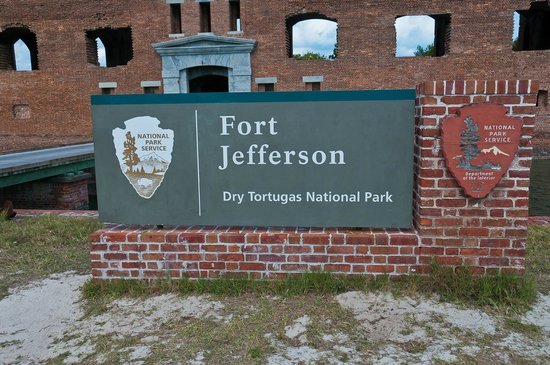
Highlights: Brown Booby (on national park channel markers), Masked Booby (on Hospital Key), Red-footed Booby (rare), Magnificent Frigatebird, White-tailed Tropicbird (rare), Audubon's Shearwater (en-route), Roseate Tern (on national park channel markers), Sooty Tern, Bridled Tern (en-route), Brown Noddy, Black Noddy (rare), plus "Antillean" Short-eared Owl, Antillean Nighthawk, Gray Kingbird, migrant songbirds and Caribbean vagrants on Garden Key, home of historic Ft. Jefferson.
Directions: The Dry Tortugas, 68 miles west of Key West, may be reached by ferry (fee) or seaplane (fee). Restrooms available. Map
Collier County

Highlights: Limpkin, Wood Stork, Roseate Spoonbill, Barred Owl, Pileated Woodpecker, Great Crested Flycatcher, Blue-gray Gnatcatcher, Tufted Titmouse, Carolina Wren, Eastern Bluebird and Northern Parula year-round. Large concentrations of wading birds along Tamiami Trail during spring. Yellow-billed Cuckoo, Swallow-tailed Kite, Eastern Kingbird, Red-eyed Vireo and Prothonotary Warbler in spring and summer.
Directions: From Florida's Turnpike, exit at Tamiami Trail (US 41, exit 25). Drive west 27.3 miles to the east entrance to the preserve (no fee, open 24 hours a day).
Following are a few recommended stops along Tamiami Trail within the preserve:

Highlights: This backcountry road begins at Fortymile Bend in Miami-Dade County, passes through Monroe County and ends at Monroe Station in Collier County. Look in pineland areas along the road for Eastern Bluebird, Brown-headed Nuthatch and Pine Warbler. The Tree Snail Hammock Nature Trail can be good for migrant and wintering songbirds. At Sweetwater Strand and other areas of cypress swamp, Barred Owl, Tufted Titmouse, Blue-gray Gnatcatcher and Northern Parula can be found year-round. Look for Yellow-billed Cuckoo, Eastern Kingbird, Red-eyed Vireo and Prothonotary Warbler during the breeding season. Birdability Site Review
Directions: From Florida's Turnpike, exit at Tamiami Trail (US 41, exit 25). Drive west 27.2 miles to the east entrance to Loop Road at Fortymile Bend, on the left just before entering Big Cypress National Preserve. From there, it is about 23.5 miles to the west end of the road at Monroe Station, back on Tamiami Trail. The road is paved at the east end for the first eight miles. Map

Highlights: Around the parking area and along a boardwalk between the visitor center and Tamiami Trail, look for a variety of wading birds, including Wood Stork and Roseate Spoonbill. Watch overhead during spring and summer for Swallow-tailed Kite.
Directions: The visitor center (no fee, open 9 AM to 4:30 PM) is located on the north side of Tamiami Trail, 15 miles west of the east entrance to Loop Road at Fortymile Bend. The southern terminus of the Florida Trail is located on the west side of the visitor center. Restrooms available. Map
Highlights: This half-mile boardwalk (wheelchair accessible) provides access to the interior of a cypress dome. Look for Eastern Bluebird, Tufted Titmouse and migrant and wintering songbirds along the boardwalk. Birdability Site Review
Directions: The parking area (no fee, open sunrise to sunset) is located on the south side of Tamiami Trail, 3.3 miles west of Monroe Station. Restrooms available. Map

Highlights: A 17-mile scenic drive on unpaved roads through cypress swamp, sawgrass prairie and pine rocklands. The loop drive begins at H.P. Williams Wayside, located at the intersection of Tamiami Trail and Turner River Road (CR 839). Look for Limpkin, Wood Stork and other wading birds, Swallow-tailed Kite (spring/summer) and Barred Owl along the boardwalk at the wayside park or in other areas of cypress swamp. Brown-headed Nuthatch and Eastern Bluebird can be found in pine flatwoods along the loop drive.
Directions: H.P. Williams Wayside Park is 6.8 miles west of Kirby Storter Boardwalk, or 11.5 miles east of the intersection of Tamiami Trail with FL 29. From the wayside park, drive north on Turner River Road for 7.2 miles to Wagonwheel Road (CR 837). Turn left and drive west 4.9 miles to Birdon Road (CR 841). Turn left and drive south 4.3 miles to return to Tamiami Trail. Restrooms available. Map
Fakahatchee Strand Preserve State Park

Highlights: Fakahatchee Strand, known as the “Amazon of North America,” is a 20-mile-long area of cypress swamp, but the preserve also includes areas of tropical hardwood hammock and pine rocklands. Popular birding areas within the preserve include Janes Scenic Drive, a 6-mile unpaved road with several side trails, and Big Cypress Bend, a 2,000-foot boardwalk (wheelchair accessible). Look for nesting Bald Eagles, Barred Owl, Pileated Woodpecker, Swallow-tailed Kite during spring and summer, plus migrant and wintering songbirds.
Directions: From I-75 (Alligator Alley), exit at FL 29 (Exit 80). Drive south 14 miles to Janes Scenic Drive. Drive west 0.3 miles, bear right and drive 0,5 miles to the park headquarters (no fee, open sunrise to sunset). To reach Big Cypress Bend (currently closed for renovations), return to FL 29 and drive south 2.5 miles to Tamiami Trail (US 41). Turn right and drive west 7 miles to the parking area.
Ten Thousand Islands National Wildlife Refuge, Marsh Trail

Highlights: A paved trail leads to an observation tower (lower level is wheelchair accessible). Look for water birds year-round, including American White Pelican, Wood Stork and Roseate Spoonbill, and ducks and shorebirds from fall through spring. Birdability Site Review
Directions: The parking area (no fee, open sunrise to sunset) is located on the south side of Tamiami Trail, 5.8 miles west of Big Cypress Bend Boardwalk. Map
Collier-Seminole State Park
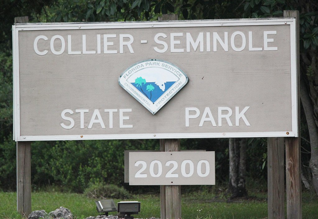
Highlights: This park provides opportunities for hiking and canoeing. Look for White-crowned Pigeon, Wood Stork, Roseate Spoonbill, Swallow-tailed Kite (summer), Bald Eagle, migrant and wintering songbirds.
Directions: The park entrance (fee, open 8 AM to sunset) is located on the south side of Tamiami Trail, 2.7 miles west of Ten Thousand Islands National Wildlife Refuge’s Marsh Trail. From Naples, the park entrance is 8.2 miles east of the intersection of Tamiami Trail and Collier Blvd. (CR 951). Restrooms available. Map
Tigertail Beach Park, Marco Island

Highlights: Look for Magnificent Frigatebird, Least Tern (summer), Black Skimmer, Reddish Egret, Roseate Spoonbill and Bald Eagle, plus an assortment of resident, migrant and wintering shorebirds, including American Oystercatcher, Wilson’s, Piping and Snowy Plover, Whimbrel, Marbled Godwit Red Knot, and occasionally Long-billed Curlew. Burrowing Owls can be found in marked burrows along Kendall Drive and elsewhere on Marco Island. During summer, look for Gray Kingbird on wires anywhere on the island.
Directions: From I-75, exit at Collier Blvd. (CR 851, Exit 101). Drive south 15 miles to Kendall Drive on Marco Island. Turn right and drive west 0.6 miles to Hernando Drive. Turn left and drive south 0.2 miles to the entrance (fee, open 8 AM until sunset). Restrooms available. Map
Eagle Lakes Community Park
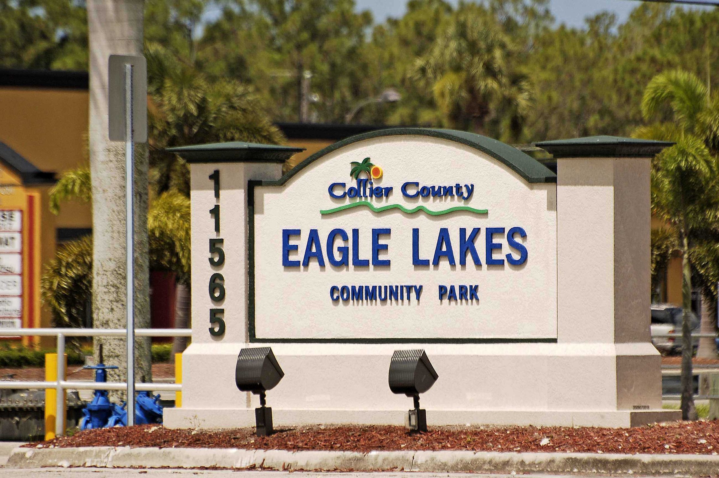
Highlights: Paved walkways encircle freshwater impoundments. Look for Black-bellied Whistling Duck, Mottled Duck, Purple Gallinule, Limpkin, Wood Stork, Roseate Spoonbill, Swallow-tailed Kite (summer) and Shiny and Bronzed Cowbird.
Directions: From I-75, exit at Collier Blvd. (CR 851, Exit 101). Drive south 7 miles to Tamiami Trail (US 41). Turn right and drive north 1.5 miles to the park entrance (no fee, open 8 AM to 10 PM, wheelchair accessible). Restrooms available. Map
Naples Botanical Garden

Highlights: The gardens include a large lake, wetlands and an upland area of pine flatwoods and coastal scrub. Look for Mottled Duck, Black-necked Stilt, Wood Stork, Roseate Spoonbill, Swallow-tailed Kite (summer), Bald Eagle, Rose-ringed Parakeet and migrant and wintering songbirds. Birdability Site Review
Directions: From I-75 in Naples, exit at Collier Blvd. (CR 851, Exit 101). Drive south 7 miles to Tamiami Trail (US 41). Turn right and drive north 4.5 miles to Thomassan Drive. Turn left and drive west 1.5 miles to Bayshore Drive. Turn left and drive south 0.1 mile to the entrance (fee, open 9 AM to 5 PM (Oct - May), 9 AM to 2 PM (June - Sept). Restrooms available. Map
Sugden Regional Park

Highlights: From the walking path around 60-acre Lake Avalon, look for Mottled Duck, Limpkin, Bald Eagle, Swallow-tailed Kite (summer), Rose-ringed Parakeet, wintering ducks and migrant and wintering songbirds.
Directions: From I-75, exit at Collier Blvd. (CR 851, Exit 101). Drive south 7 miles to Tamiami Trail (US 41). Turn right and drive north 5.2 miles to Avalon Drive. Turn left and drive west 0.1 mile to the park entrance. (no fee, open 8 AM to sunset). Restrooms available. Map
Picayune Strand State Forest

Highlights: This 78,000-acre forest, mostly wet pine flatwoods, wet prairie and cypress swamp, was the site of the infamous Golden Gate Estates land scheme in the mid-20th century, which severely altered the hydrology of the area. Beginning in 1985, the state began acquiring the land from thousands of absentee landlords. It was declared a state forest in 1995 and ecological restoration is ongoing.
Two popular birding locations within the forest are the Belle Mead Horse Trail and the Sabal Palm Trail. Look for Northern Bobwhite, Wild Turkey, Chuck-will’s-widow (summer), Wood Stork, Swallow-tailed Kite (summer), Bald Eagle, Barred Owl, Red-headed, Red-cockaded and Hairy Woodpecker, Brown-headed Nuthatch and Eastern Bluebird. Both trails may become flooded during the summer rainy season.
Directions: From I-75, exit at Collier Blvd. (CR 851, Exit 101). To reach the Belle Mead Horse Trail, drive south 0.3 miles to Beck Blvd. Turn left and drive east 1.4 miles to Benfield Road. Turn right and drive south 1 mile to Newman Drive. Turn left and drive east 0.6 miles to the parking area (fee, open sunrise to sunset). To reach the Sabal Palm Trail, return to Collier Blvd. and drive south 4 miles to Sabal Palm Road. Turn left and drive east 3.2 miles to the trailhead (fee, open sunrise to sunset). Map
Fred W. Coyle Freedom Park

Highlights: A 50-acre park with hiking trails and a 3,500-foot boardwalk. Look for Mottled Duck, Limpkin, Wood Stork, Swallow-tailed Kite (summer), Gray Kingbird (summer) and migrant and wintering songbirds.
Directions: From I-75, exit at Golden Gate Parkway (CR 886, Exit 105). Drive west 3.5 miles to the park entrance (no fee, open 7 AM to sunset). Restrooms available. Map
Clam Pass Park
Highlights: A boardwalk leads from the parking area through a mangrove forest to a sandy beach. Mottled Duck, shorebirds, gulls and terns, Black Skimmer, Magnificent Frigatebird, Redish Egret.
Directions: From I-75, exit at Pine Ridge Road (CR 896, Exit 107). Drive west 4.8 miles to the park entrance (fee, open 8 AM to sunset). Restrooms available. Map
Corkscrew Regional Ecosystem Watershed, Bird Rookery Swamp

Highlights: Twelve miles of hiking trails, including a 1,500-foot boardwalk. Look for Wood Duck, Mottled Duck, Wild Turkey, Purple Gallinule, Limpkin, Wood Stork, Roseate Spoonbill, Swallow-tailed Kite (summer), Barred Owl and migrant and wintering songbirds. Birdability Site Review
Directions: From I-75, exit at Immokalee Road (Exit 111). Drive east 11.3 miles to Shady Hollow Blvd. Turn left and drive 2.4 miles to the entrance (no fee, open sunrise to sunset). Portable restrooms available. Map
Corkscrew Swamp Sanctuary

Highlights: Along the 2-mile boardwalk, look for Purple Gallinule, Limpkin and Barred Owl year-round, nesting Wood Stork during late winter, and Swallow-tailed Kite during spring and summer. Painted Buntings come to feeders along the boardwalk during winter. During sprin g and fall, a variety of migrant songbirds may be found. Birdability Site Review
Directions: From I-75, exit at Immokalee Road (Exit 111). Drive east 15.2 miles to Sanctuary Road. Turn left and drive 1.5 miles to the entrance (fee: advance online reservations required, discount for National Audubon Society members, open 7:00 AM to 5:30 PM, until 7:30 PM during spring and summer, wheelchair accessible). Restrooms available.Map
Delnor-Wiggins Pass State Park

Highlights: The park includes a one-mile sandy beach. Mangrove Cuckoo, Magnificent Frigatebird, Reddish Egret, Roseate Spoonbill, Bald Eagle, shorebirds, gulls, terns, migrant and wintering songbirds.
Directions: From I-75, exit at Immokalee Road (Exit 111). Drive west 5.2 miles to the park entrance (fee, open 8 AM to sunset). Restrooms available. Map
Broward County

Highlights: Shorebirds may be seen at low tide from the end of the boardwalks.
Directions: From I-95, exit at Sheridan Street (exit 21). Drive east 2.5 miles to the entrance (no fee, open 9:00 AM to 6:00 PM (until 7:30 PM during summer, wheelchair accessible). Restrooms available. Map
Dr. Von D. Mizell-Eula Johnson State Park

Highlights: Pelagic species are possible around the jetty area (at the north end of the park road) during extended periods of strong easterly winds. Migrant songbirds and Caribbean vagrants are possible in patches of coastal hammock.
Directions: From I-95, exit at Sheridan Street (exit 21). Drive east 2.8 miles to FL A1A. Turn left and drive north 1.5 miles to the entrance (fee, open 8:00 AM until sunset). Restrooms available. Map
Evergreen Cemetery

Highlights: Migrant songbirds and Caribbean vagrants (most recently, Bahama Mockingbird and Western Spindalis) are possible in trees along the eastern and northern perimeter of the cemetery.
Directions: From I-95, exit at Davie Boulevard (exit 26). Drive east 2 miles to US 1. Turn right and drive south 0.1 miles to SE 13 Street. Turn left and drive east 0.2 miles to the entrance (no fee, open sunrise to sunset). Map
Hugh Taylor Birch State Park

Highlights: Look for migrant and wintering songbirds and possibly Caribbean vagrants along the main park road and nature trails within the park.
Directions: From I-95, exit at Sunrise Boulevard (exit 29). Drive east 4 miles to the entrance (fee, open 8:00 AM until sunset). Restrooms available. Map
Richardson Historic Park and Nature Preserve

Highlights: Look for migrant and wintering songbirds along the boardwalk (a Kirtland's Warbler was found here in October, 2011). A variety of parrots can be found in and around this park, including Red-crowned Parrot and Blue-crowned, Mitred and Red-masked Parakeets.
Directions: From I-95, exit at Oakland Park Boulevard (Exit 31). Drive east 0.9 miles to North Andrews Avenue. Turn right and drive south 0.8 miles to NE 21 Court. Turn left and drive east 0.3 miles to Wilton Drive. Turn right and drive south 1 block to NE 20 Street. Turn right to the park entrance (no fee, open 8:00 AM to 6:00 PM, wheelchair accessible). Restrooms available. Map
Fern Forest Nature Center

Highlights: Migrant and wintering songbirds, Great Horned, Barred and Eastern Screech-Owl may be seen from the trails and boardwalks.
Directions: From Florida's Turnpike, exit at Atlantic Boulevard (exit 66). Drive west 0.2 miles to Lyons Road (exit on right). Drive south 0.2 miles to the entrance (no fee, open 8:00 M to 6:00 PM, wheelchair accessible). Restrooms available. Map
Tall Cypress Natural Area

Highlights: Great Horned and Eastern Screech-Owl, a variety of raptors, woodpeckers and migrant and wintering songbirds may be seen from the boardwalk. Nanday Parakeets breed here; Mottled Duck and Limpkin are possible at the pond at the park's north end.
Directions: From Florida's Turnpike, exit at Sample Road (exit 69). Drive west 2.8 miles to Turtle Run Boulevard. Turn right and drive north 0.1 mile to the park entrance (no fee, open sunrise to sunset, wheelchair accessible). Restrooms available. Map
Plantation Preserve

Highlights: A 1-mile linear trail passes through wetlands adjacent to a golf course. Look for Egyptian Goose, Mottled Duck, Purple Gallinule, Gray-headed Swamphen, Limpkin, Wood Stork, Least Bittern, Monk, White-winged and Yellow-chevroned Parakeet, Spot-breasted Oriole and migrant and wintering songbirds.
Directions: From I-595, exit at University Drive. Drive north 1.6 miles to Broward Blvd. Turn right and drive east 0.7 miles to SW 70 Avenue. Turn right and drive south 0.1 mile to the parking area (no fee, open sunrise to sunset). The linear trail begins on the east side of the parking area. Map
Tree Tops Park

Highlights: Look for Mottled Duck, Least Bittern and Purple Gallinule from the marsh boardwalk, Painted Bunting in brushy areas, migrant and wintering songbirds in oak hammocks.
Directions: From I-595, exit at Nob Hill Road (eastbound exit 3, westbound exit 4). Drive south 2.4 miles to the entrance (fee on weekends, open 9:00 AM to 6:00 PM, open until 7:30 PM during summer). Restrooms available. Map
Flamingo Gardens
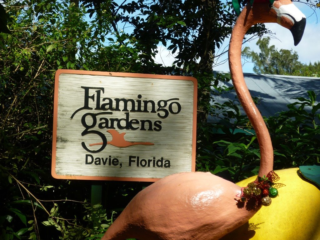
Highlights: The rookery attracts Black-crowned Night-Heron, Wood Stork and Roseate Spoonbill year-round. Swallow-tailed Kite nests during summer and Limpkins have been seen at the back lake. Painted Buntings may be seen during winter throughout the property.
Directions: From I-595, exit at Flamingo Road (Exit 1B). Drive south 2.5 miles to the entrance, at SW 36th Court, one block north of Griffin Rd in Davie (fee, open 9:30 AM to 5:00 PM). Restrooms available. Map
Long Key Nature Center

Highlights: A boardwalk and nature trails provide access to wetlands and upland oak hammocks. Wood Duck, Mottled Duck, Purple Gallinule, Limpkin, Wood Stork, migrant and wintering songbirds.
Directions: From I-595, exit at Flamingo Road (Exit 1B). Drive south 2.5 miles to SW 36 Court. Turn left and drive west 0.5 miles to SW 130 Avenue. Turn right and drive north 0.1 mile to the entrance (no fee, open 9 AM to 5 PM). Restrooms available. Map
Brian Piccolo Park

Highlights: Burrowing Owls are common at marked burrows throughout the park. Monk Parakeets are also common.
Directions: From I-75, exit at Sheridan Street. Drive east 4 miles to the entrance (fee on weekends, open 9:00 AM until 6:00PM). Restrooms available. Map
Chapel Trail Nature Preserve

Highlights: Gray-headed Swamphen are common here. Also look for Mottled Duck, Least Bittern, Purple Gallinule and Limpkin along the preserve’s boardwalk system.
Directions: From I-75, exit at Sheridan Street. Drive west 3.5 miles to the entrance (no fee, open 8:00 AM until sunset, wheelchair accessible). Map
Vista View Park

Highlights: Burrowing Owls can be found on the park’s big hill. Around the park’s lakes, look for Egyptian Goose, Mottled Duck, Purple Gallinule, Gray-headed Swamphen and Limpkin.
Directions: From I-75, exit at Griffin Road (Exit 13) Drive east 0.4 miles to Winkopp Bridge. Turn left, cross the bridge, then turn right onto Orange Drive. Drive east 0.2 miles to Boyscout Road (SW 142 Avenue). Turn left and drive north 0.2 miles to the park entrance (fee on weekends, open 8 AM to 7:30 PM) Restrooms available.Map
Markham Park
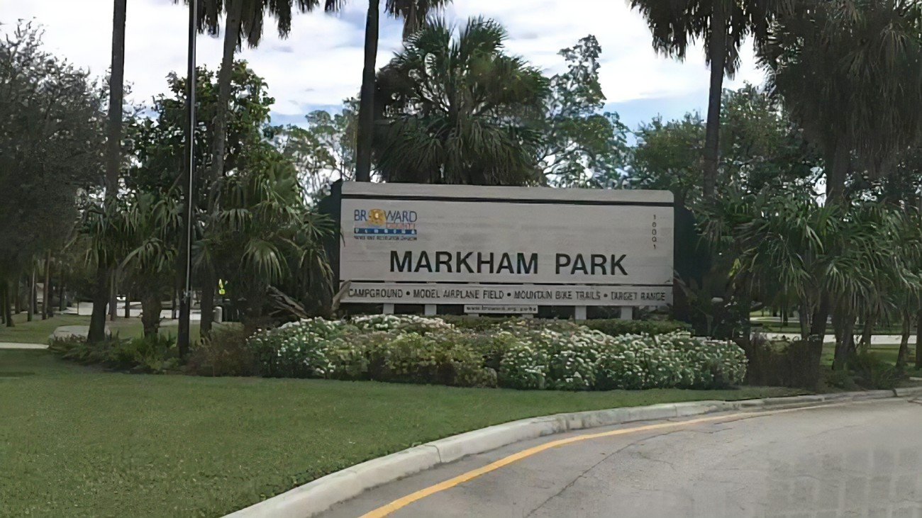
Highlights: Spot-breasted Orioles have been found on the nature trail; the trailhead is just west of the t-intersection beyond the entrance station. Least Bittern, Wood Stork, Snail Kite, King Rail, Purple Gallinule, Gray-headed Swamphen and Limpkin can be found in the Water Conservation Area immediately west of the park.
Directions: From I-595, exit at 136 Street (exit 1A). Drive west 2.0 miles on FL 84 (which parallels I-595) to the park entrance (fee on weekends, open 9:00 AM until 6:00PM). Restrooms available. Map
Francis S. Taylor Wildlife Management Area, Everglades Pkwy. Rest Area

Highlights: This rest area on I-75 (Alligator Alley) includes a boardwalk and observation tower and provides access to sawgrass marsh habitat in water conservation areas on both sides of the highway. Look for Mottled Duck, King Rail, Purple Gallinule, Limpkin, Wood Stork, Least Bittern, Roseate Spoonbill, Snail Kite and migrant and wintering songbirds.
Directions: The rest area is at mile marker 35 on I-75 (Alligator Alley). Restrooms available.Map
Snake Road

Highlights: Look for Wild Turkey, White-tailed Kite, Crested Caracara, Sandhill Crane, Limpkin and Burrowing Owl as you drive north through the Miccosukee and Big Cypress Seminole Reservations (observe posted speed limits) to SR 846.
Directions: From I-75 (Alligator Alley), exit at Snake Road (CR 833, Exit 49). Restrooms available at the Miccosukee service plaza. Map
Palm Beach County

Highlights: Look for migrant songbirds and Caribbean vagrants along the park's nature trail.
Directions: From I-95, exit at Palmetto Park Road (exit 44). Drive east 3 miles to FL A1A. Turn left and drive north 2 miles to the entrance (fee, open 8:00 AM until sunset; free, but limited parking is available along Spanish River Boulevard, north of the park). Restrooms available. Map
Wakodahatchee Wetlands

Highlights: Along the 1/2-mile boardwalk, look for Black-bellied Whistling-Duck, Least Bittern, Purple Gallinule, Gray-headed Swamphen and Limpkin. Nanday Parakeet and Spot-breasted Oriole is occasionally seen in the area. During winter, look for wintering ducks, American Bittern, Sora and Wilson's Snipe. A wide variety of waders, including Wood Stork, nest here during late winter and spring. Birdability Site Review
Directions: From Florida's Turnpike, exit at Atlantic Avenue (exit 81). Drive east 1.7 miles to Jog Road. Turn left and drive north 1.5 miles to the entrance (no fee, open sunrise to sunset, wheelchair accessible). Restrooms available. Map
Green Cay Nature Center and Wetlands

Highlights: Along the 1.5-mile boardwalk, look for Black-bellied Whistling-Duck, Wood Duck, Least Bittern, Purple Gallinule, Gray-headed Swamphen and Limpkin. During winter, look for wintering ducks, American Bittern, Roseate Spoonbill, Sora and Wilson's Snipe; Painted Buntings visit feeders in hammock areas along the boardwalk. Birdability Site Review
Directions: From Florida's Turnpike, exit at Atlantic Avenue (exit 81). Drive east 0.7 miles to Hagen Ranch Road. Turn left and drive north 2.2 miles to the entrance (no fee, open sunrise to sunset, wheelchair accessible). Restrooms available. Map
Arthur R. Marshall Loxahatchee National Wildlife Refuge

Highlights: Check around the visitor center and on the Cypress Swamp Boardwalk for owls and migrant and wintering songbirds. Along the Marsh Trail, look for Wood Duck, Wood Stork, Roseate Spoonbill, Snail Kite, Purple Gallinule, Limpkin and Nanday Parakeets.
Directions: From Florida's Turnpike, exit at Boynton Beach Boulevard exit 86). Drive west 2 miles to US 441. Turn left and drive south 2 miles to the entrance (fee, open sunrise to sunset). Restrooms available. Map
Ocean Inlet Park (Boynton Inlet)

Highlights: The fishing pier on the north jetty at Boynton Inlet is a popular sea watching location. During periods of persistent easterly winds, scoters (winter), jaegers (fall), alcids (rare, winter), pelagic terns (summer), loons (winter) storm-petrels (spring), shearwaters (summer/fall) and gannets (winter) may be seen close to shore. Magnificent Frigatebird is present year-round. Nanday Parakeets are often seen in the parking area.
Directions: From I-95 in Boynton Beach, exit at Woolbright Road (Exit 56). Drive east 1 mile to FL A1A. Turn left and drive north 2 miles to the inlet (no fee, open sunrise to sunset). Restrooms available. Map
Lantana Nature Preserve

Highlights: This small park can be excellent for migrant songbirds. Several Caribbean vagrants have been found here in the past few years, including La Sagra’s Flycatcher (2015), Key West Quail-Dove (2018), Bahama Mockingbird (2018, 2019) and Red-legged Thrush (2019), as well as Kirtland’s Warbler (2018).
Directions: From I-95, exit at Lantana Road (Exit 61). Drive east 1 mile to US 1. Turn right and drive south 0.2 miles to East Ocean Avenue. Turn left and drive east 0.6 miles to the entrance (no fee, open 7:30 AM to 5:00 PM). Map
John Prince Park

Highlights: The park’s Custard Apple Trail provides access to a variety of habitats including hardwood swamp, maritime hammock, pine flatwoods, and wet prairie. Black-bellied Whistling-Duck, Egyptian Goose, Mottled Duck, Purple Gallinule, Limpkin, Wood Stork, Roseate Spoonbill, Monk and Nanday Parakeet, migrant and wintering songbirds.
Directions: From I-95, exit at S 6 Avenue (exit 63). Drive west 1.3 miles to Congress Avenue. Turn left and drive south 0.3 miles to the park entrance (no fee, open sunrise to sunset). Restrooms available. Map
Snook Islands Natural Area

Highlights: A boardwalk provides access to a restored wetland in Lake Worth Lagoon. American Oystercatcher breed here. Also look for migrant and wintering shorebirds, including Piping Plover, Whimbrel and Red Knot, and gulls and terns, including Least Tern (summer). Monk and Nanday Parakeets are often seen at adjacent Bryant Park and Lake Worth Beach golf course.
Directions: From I-95 in Lake Worth, exit at South 6 Avenue (Exit 66). Drive east 1.5 miles to US 1. Turn left and drive north 1.5 miles to North 2 Avenue. Turn right and drive east to North Golfview Drive. Turn right and drive south to a parking area adjacent to the Lake Worth golf course. Restrooms available at Bryant Park. Map
Okeeheelee Nature Center

Highlights: Painted Bunting is regular during winter at the nature center feeders. Look for Wood Duck and Sandhill Crane in surrounding wetlands.
Directions: From Florida's Turnpike, exit at Lake Worth Road (exit 93). Drive east 0.8 miles to Pinehurst Drive. Turn left and drive north 2.2 miles to Forest Hills Boulevard. Continue north into Okeeheelee Park. Follow the signs for 2 miles to the nature center (no fee, open sunrise to sunset, wheelchair accessible). Restrooms available. Map
Peaceful Waters Sanctuary

Highlights: This created wetland within Village Park includes a 1,500-foot boardwalk (wheelchair accessible). Look for Black-bellied Whistling-Duck, Wood Duck, Mottled Duck, Purple Gallinule, Gray-headed Swamphen, Limpkin, Wood Stork, Roseate Spoonbill and wintering waterfowl and shorebirds. Birdability Site Review
Directions: From Florida’s Turnpike, exit at Lake Worth Boulevard (Exit 93). Drive west 4 miles to 120 Avenue South. Turn right and drive north 0.6 miles to the park entrance (no fee, open sunrise to sunset). Restrooms available in Village Park. Map
Wellington Environmental Preserve

Highlights: The preserve's impoundments, accessed via a 2.5-mile trail and boardwalk system that includes a six-story observation tower, attract a variety of wintering waterfowl. Limpkin is common here. Also look for Mottled Duck, Wood Stork, Roseate Spoonbill, Snail Kite and Bald Eagle.
Directions: From Florida's Turnpike in West Palm Beach, exit at Southern Boulevard/FL 80 (Exit 97). Drive west 8 miles to Flying Cow Road. Turn left and drive south 3.5 miles to the parking area (no fee, open sunrise to sunset, wheelchair accessible). Restrooms available. Map
Stormwater Treatment Areas 3/4 / Harold Campbell Public Use Area

Highlights: The impoundments at STA 3/4 attract a variety of migrant shorebirds and wintering waterfowl. Also look for Mottled Duck, Least Bittern, Wood Stork, Roseate Spoonbill, Snail Kite, Bald Eagle, Gray-headed Swamphen and Limpkin.
Directions: From I-75 in Broward County, exit at US 27. Drive north 15 miles to Holey Land Road, at the Palm Beach County line. Turn left and drive west 0.5 miles to an impoundment overlook. Continue west 5 miles on Holey Land Road to the public use area (no fee, open Friday-Monday from sunrise to sunset). Restrooms available. Map
Everglades Agricultural Area

Highlights: During August and September, impressive numbers of migrant shorebirds, including Black-necked Stilt, American Avocet and Wilson's Phalarope, a variety of terns including Gull-billed, Caspian, Least, and Black Tern and spectacular assemblages of herons, egrets, ibis and other wading birds are attracted to flooded agricultural fields in the Belle Glade area south of Lake Okeechobee. Look for Pectoral, Upland and possibly Buff-breasted Sandpiper on sod farms in the area. Black-bellied and Fulvous Whistling-Duck, King Rail, Purple Gallinule, Gray-headed Swamphen, Limpkin, Least Bittern, Wood Stork, Roseate Spoonbill, Snail Kite and Bald Eagle can be found here year-round. Yellow-headed Blackbird and Shiny Cowbird can sometimes be found at the Sem-Chi rice plant on Atlantic Mill Road (bird from the road and don't trespass onto the mill property).
Directions: From I-75 in Broward County, exit at US 27. Drive north 21.5 miles to the south entrance of A-1 Flow Equalization Basin (A1-FEB), on the west side of US 27 between mile marker 52 and 53 (no fee, open Friday-Sunday from sunrise to sunset) The north entrance (currently closed due to ongoing construction) is 7.5 miles north at mile marker 60. Impoundments along A1-FEB's 20-mile loop road attracts all the resident species listed above as well as waterfowl and shorebirds during winter. Various bridges on the east side of US 27 provide access to adjacent agricultural fields and sod farms. Observe all “no trespassing” signs. Portable restrooms available at A1-FEB. Map
The area may also be accessed from West Palm Beach. From I-95 or Florida's Turnpike, exit at Southern Boulevard. Drive west to the merge with US 441, continue west 11.5 miles to the intersection with CR 880, on the left. An entrance to Stormwater Treatment Area 1-E is on US 441, just east of this intersection, while an entrance to Stormwater Treatment Area 1-W is on the south side of CR 880, just west of the intersection. Flooded agricultural fields and sod farms may be found anywhere along CR 880 or on side roads with public access, including Atlantic Mill Road (4 miles west of the US 441/CR 880 intersection), Gladeview Road (2.7 miles farther west), Sam Senter Road (another 2.8 miles farther west) and Browns Farm Road (another 3.7 miles farther west). Observe all “no trespassing” signs. Map
Belle Glade Marina and Torry Island

Highlights: A walkway and observation tower adjacent to the Torry Island campground provides access to wetlands on an island at the south end of Lake Okeechobee. This location also provides access to the Lake Okeechobee Scenic Trail, the 110-mile trail on the Hoover Dike that encircles the lake. Look year-round for Black-bellied and Fulvous Whistling-Duck, Mottled Duck, Purple Gallinule, Gray-headed Swamphen, Limpkin, Least Bittern, Wood Stork, Roseate Spoonbill, Snail Kite and Bald Eagle. Gray Kingbird are present during summer and Tropical Kingbird and Vermilion Flycatcher have wintered. Orchard Oriole has bred here, considerably south of its known breeding range. A small population of Tricolored Munia (provenance unknown) has wintered here since 2022.
Directions: From FL 80 in Belle Glade, drive west 3.6 miles on CR 717 to Torry Island (no fee, open sunrise to sunset). Map
Winding Waters Natural Area

Highlights: Paved walking trail leading to observation platform, unpaved hiking trails. Look for Black-bellied Whistling-Duck, Mottled Duck, Purple Gallinule, Gray-headed Swamphen, Limpkin, Wood Stork, Roseate Spoonbill, Swallow-tailed Kite (spring/summer), Snail Kite, Bald Eagle.
Directions: From I-95, exit at Blue Heron Blvd. (FL 708, Exit 76). Drive west 0.7 miles to N Military Trail. Turn left and drive south 0.4 miles to Dyer Blvd. Turn right and drive west 1 mile to the entrance (no fee, open sunrise to sunset). Map
J.W. Corbett Wildlife Management Area

Highlights: Hungryland Boardwalk is a 1.2-mile elevated boardwalk and trail through pine flatwoods, oak hammocks and a cypress swamp. Unpaved forest roads provide access to the rest of the WMA. Seasonal hunting is allowed, except in the Hungryland Boardwalk area.
Look for Wood Duck, Northern Bobwhite, Wild Turkey, Limpkin, Sandhill Crane, Wood Stork, Swallow-tailed Kite (spring/summer), Snail Kite, Red-cockaded and Hairy Woodpecker, Eastern Bluebird and Bachman’s Sparrow.
Directions: Hungryland Boardwalk entrance: From I-95, exit at W Blue Heron Blvd. (FL 708, Exit 76). Drive west 1 mile to FL 710. Turn right and drive north 3 miles to Northlake Blvd. Turn left and drive west 8.7 miles to Seminole Pratt Whitney Road. Turn right and drive north 3 miles to Stumpers Grade Road. Turn left and drive west 0.8 miles to the trailhead parking area (no fee, open sunrise to sunset). North entrance: Return to FL 710, turn left and drive north 20 miles to the entrance (fee, open sunrise to sunset). Check the hunt calendar before visiting. Map
Loxahatchee Slough Natural Area

Highlights: Paved walking trail leading to observation platform, unpaved hiking trails. Look for Black-bellied Whistling-Duck, Wood Duck, Mottled Duck, Limpkin, Sandhill Crane, Wood Stork, Roseate Spoonbill, Swallow-tailed Kite (spring/summer), Snail Kite, Barred Owl.
Directions: From I-95, exit at W Blue Heron Blvd. (FL 708, Exit 76). Drive west 1 mile to FL 710. Turn right and drive north 8 miles to the entrance (no fee, open sunrise to sunset). Restrooms available. Map
Frenchman’s Forest

Highlights: Paved and unpaved trails and an elevated boardwalk through a cypress swamp. Look for Wood Duck, migrant and wintering songbirds.
Directions: From I-95, exit at PGA Blvd. (FL 786, Exit 79). Drive east 2 miles to Prosperity Farms Road. Turn left and drive north 0.8 miles to the parking area (no fee, open sunrise to sunset). Map
John D. MacArthur Beach State Park

Highlights: Shorebirds, gulls and terns on the beach, migrant and wintering songbirds on the Satinleaf nature trail.
Directions: From I-95, exit at PGA Blvd. (FL 786, Exit 79). Drive east 2.6 miles to US1. Continue east onto Jack Nicklaus Drive (FL A1A). Drive east, then south 2 miles to the park entrance (fee, open 8 AM to sunset). Restrooms available. Map
Riverbend Park

Highlights: Fifteen miles of hiking trails provide access a mosaic of habitats including pine flatwoods, cypress swamps, oak hammocks, and wet prairies. Look for Black-bellied Whistling-Duck, Wood Duck, Mottled Duck, Wild Turkey, Limpkin, Sandhill Crane, Wood Stork, Swallow-tailed Kite (spring/summer), Barred Owl, Tufted Titmouse, migrant and wintering songbirds.
Directions: From I-95, exit at Indiantown Road (Exit 87). Drive west 1.8 miles to the entrance (no fee, open sunrise to sunset). Restrooms available. Map
Hendry County
Levee Park, Clewiston (Lake Okeechobee Scenic Trail)

Highlights: This park provides access to the Lake Okeechobee Scenic Trail, a 110-mile trail on the Hoover Dike that encircles the lake. Look for Purple Gallinule, Gray-headed Swamphen, Limpkin, Wood Stork, Snail Kite and Bald Eagle.
Directions: From US 27 in Clewiston, turn right at S Fransisco Street. Drive north 0.4 miles to Hoover Dike Road. Turn left and drive west 0.2 miles to the parking area (no fee, open sunrise to sunset. Map
Stormwater Treatment Area 5/6 (Hendry County)
Highlights: Access via regular tours only. See the STA 5/6 Schedule for dates, directions and registration details. The impoundments at STA-5/6 attract a variety of migrant shorebirds and wintering waterfowl. Also look for Black-bellied and Fulvous Whistling Duck, Mottled Duck, Least Bittern, Wood Stork, Roseate Spoonbill, Snail Kite, Bald Eagle, Crested Caracara, Purple Gallinule, Gray-headed Swamphen and Limpkin. Directions: See the STA 5/6 Schedule for current directions to the tour meeting location. Map
Dinner Island Ranch Wildlife Management Area

Highlights: Unpaved roads provide access to a wide variety of habitats including dry prairie, cypress domes, freshwater marshes, pine flatwoods and oak hammocks. Northern Bobwhite, Wild Turkey, Limpkin, Sandhill Crane, Wood Stork, Roseate Spoonbill, Swallow-tailed Kite (spring/summer), Snail Kite and Crested Caracara. Seasonal hunting is allowed at this location.
Directions: From I-75 (Alligator Alley), exit at Snake Road (CR 833, Exit 49). Drive north 35.8 miles to the entrance (no fee, open sunrise to sunset). Check the hunt calendar before visiting. Map
Okaloacoochee Slough State Forest/Wildlife Management Area

Highlights: Nearly 40 miles of trails provide access to a variety of habitats including wetlands, pine flatwoods and oak hammocks. Look for Northern Bobwhite, Wild Turkey, Limpkin, Sandhill Crane, Wood Stork, Swallow-tailed Kite (spring/summer) and Crested Caracara. Seasonal hunting is allowed at this location.
Directions: From I-75 (Alligator Alley), exit at FL 29 (Exit 80). Drive north 32.5 miles to Keri Road (CR 232). Turn right and drive east 8.8 miles to the entrance (no fee, open sunrise to sunset). Check the hunt calendar before visiting. Map
Spirit-of-the-Wild Wildlife Management Area
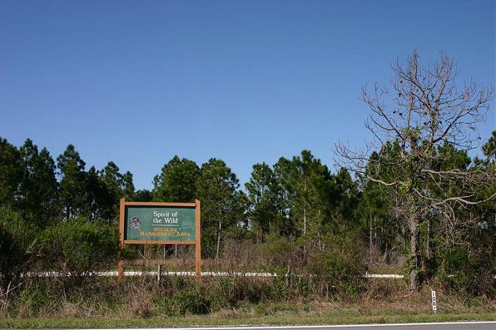
Highlights: Roads and hiking trails provide access to wetland and pine flatwoods habitat. Look for Black-bellied Whistling-Duck, Northern Bobwhite, Wild Turkey, King Rail, Sandhill Crane, Wood Stork, Roseate Spoonbill, Swallow-tailed Kite (spring/summer), Red-headed and Hairy Woodpecker. Seasonal hunting is allowed at this location.
Directions: From I-75 (Alligator Alley), exit at FL 29 (Exit 80). Drive north 32.5 miles to Keri Road (CR 232). Turn right and drive east 1.8 miles to the entrance (no fee, open sunrise to sunset). Check the hunt calendar before visiting. Map
Lee County

Highlights: Over two miles of beaches, five miles of trails through maritime hammock and mangrove forest. Look for Mottled Duck, American Oystercatcher, Snowy and Wilson’s Plover, Black Skimmer, Magnificent Frigatebird, Reddish Egret, Roseate Spoonbill, Bald Eagle, wintering shorebirds, gulls, terns and songbirds.
Directions: From I-75, exit at Bonita Beach Road (CR 865, Exit 116). Drive west 10.6 miles to the park entrance (fee, open 8 AM to sunset). Restrooms available. Map
Lakes Park

Highlights: A boardwalk and hiking trails provide access. Mottled Duck, Limpkin, Wood Stork, Least Bittern, Swallow-tailed Kite (spring/summer), Bald Eagle, migrant and wintering songbirds.
Directions: From I-75 in Ft. Myers, exit at Alico Road (CR 840, Exit 128). Drive west 3.7 miles to US 41 (Tamiami Trail). Turn right and drive north 2.7 miles to Gladiolus Drive (CR 865). Turn left and drive west 0.5 miles to the entrance (fee, open 7 AM to sunset). Restrooms available. Map
San Carlos Bay/Bunche Beach Preserve

Highlights: Mangrove forest and sandy beach habitat. Look for Mottled Duck, Mangrove Cuckoo, American Oystercatcher, Wilson’s and Snowy Plover, Least Tern (summer), Black Skimmer, Reddish Egret, Roseate Spoonbill, Bald Eagle, migrant and wintering waterfowl and shorebirds.
Directions: From I-75 in Ft. Myers, exit at Alico Road (CR 840, Exit 128). Drive west 3.7 miles to US 41 (Tamiami Trail). Turn right and drive north 2.7 miles to Gladiolus Drive (CR 865). Turn left and drive west 1.2 miles to Summerlin Road (CR 869). Turn left (flyover) and drive west 5.7 miles to John Morris Road. Turn left and drive south 1.2 miles to the beach parking area (fee, open sunrise to sunset). Restrooms available. Map
Dig Darling National Wildlife Refuge

Highlights: Along the refuge’s wildlife drive, look for Mottled Duck, Mangrove Cuckoo, Reddish Egret, Roseate Spoonbill and Bald Eagle year-round, Swallow-tailed Kite during spring and summer and a variety of waterfowl and shorebirds during the winter months. Birdability Site Review
Directions: From I-75 in Ft. Myers, exit at Alico Road (CR 840, Exit 128). Drive west 3.7 miles to US 41 (Tamiami Trail). Turn right and drive north 2.7 miles to Gladiolus Drive (CR 865). Turn left and drive west 1.2 miles to Summerlin Road (CR 869). Turn left (flyover) and drive west 8 miles to the Sanibel toll plaza. Continue west, then south 3.3 miles to Periwinkle Way. Turn right and drive west 2.5 miles, bearing right onto Palm Ridge Road, which in 0.3 miles becomes Sanibel-Captiva Road. Continue west 2.0 miles to the refuge entrance (fee, wildlife drive open Saturdays to Thursdays from one hour after sunrise to sunset). Restrooms available. Map
Six Mile Cypress Slough Preserve

Highlights: A 1.2-mile boardwalk (wheelchair accessible) provides access to cypress swamp habitat. Look for Black-bellied Whistling-Duck, Wood Duck, Mottled Duck, Yellow-billed Cuckoo (summer), Limpkin, Wood Stork, Roseate Spoonbill, Swallow-tailed Kite (spring/summer), Bald Eagle, Short-tailed Hawk, Barred Owl, Hairy Woodpecker, Tufted Titmouse, migrant and wintering songbirds.
Directions: From I-75, exit at Daniels Parkway (CR 876, Exit 131). Drive west 3 miles to Six Mile Cypress Parkway. Turn right and drive north 1.8 miles to Penzance Blvd. Turn right and drive east 0.1 mile to the entrance (fee, open 7AM-6PM). Restrooms available. Map
Rotary Park Environmental Center

Highlights: This 97-acre park has nature trails, a boardwalk and an observation tower. Look for Mottled Duck, migrant shorebirds, Roseate Spoonbill, Burrowing Owl and migrant and wintering songbirds. The city of Cape Coral has the largest Burrowing Owl population in Florida; an annual Burrowing Owl festival is based at this park.
Directions: From I-75, exit at Daniels Parkway (CR 876, Exit 131). Drive west 4.8 miles to Tamiami Trail (US 41). Turn right and drive north 0.8 miles to College Parkway. Turn left and drive west 4.2 miles to the Cape Coral Bridge and Parkway. Continue west 2.8 miles to Pelican Blvd. Turn right and drive 1 mile to the park entrance (no fee, open Monday-Saturday 8 AM to 4 PM). Restrooms available. Map
Harns Marsh
Highlights: A nearly 4-mile loop trail in freshwater marsh habitat. Look for Black-bellied Whistling-Duck, Wood Duck, Mottled Duck, Northern Bobwhite, Wild Turkey, Purple Gallinule, Gray-headed Swamphen, Limpkin, Sandhill Crane, Wood Stork, Least Bittern, Roseate Spoonbill, Swallow-tailed Kite (spring/summer), Snail Kite, Bald Eagle, Crested Caracara, wintering waterfowl, migrant shorebirds and migrant and wintering songbirds.
Directions: From I-75, exit at Daniels Parkway (CR 876, Exit 131). Drive east 5.7 miles to FL 82. Continue straight onto Gunnery Road. Drive north 2.5 miles to Lee Blvd. Turn right and drive east 1.6 miles to Sara Avenue. Turn left and drive north 0.5 miles to 12 Street. Turn right and drive east 0.1 mile to Sunshine Blvd. Turn left and drive north 1.4 miles to 31 Street. Turn left and drive 0.1 mile to Ruth Avenue. Turn right and drive north 0.4 miles to 38 Street. Turn left and drive west 0.2 miles to the entrance (no fee, open sunrise to sunset. Map
Hickey Creek Wildlife and Environmental Area

Highlights: Also known as Hickey’s Creek Mitigation Park. Two boardwalks and five miles of hiking trails. Look for Northern Bobwhite, Limpkin, Sandhill Crane, Swallow-tailed Kite (spring/summer), Red-headed Woodpecker, Florida Scrub-Jay and migrant and wintering songbirds.
Directions: From I-75, exit at East Palm Beach Blvd. (FL 80, Exit 141). Drive east 8.6 miles to the entrance (fee, open 7 AM to 7 PM). Map
Other Locations
These locations are in counties just north of south Florida:
Jonathan Dickinson State Park (Martin County)

Highlights: Wild Turkey, Sandhill Crane, Red-headed and Hairy Woodpecker and Florida Scrub-Jay may be found in sand pine scrub around the campground near the entrance. A series of mountain bike trails criss-cross this habitat. Wood Duck can be seen on the many ponds in this area. Reintroduced Red-cockaded Woodpecker and Brown-headed Nuthatch as well as Bachman's Sparrow can be found in pine flatwoods east of the Kitching Creek Trail, which begins near the picnic area at the end of the park road. Swallow-tailed Kite are present during spring and summer.
Directions: From I-95, exit at Indiantown Road (Exit 87). Drive east 4 miles to US 1. Turn left and drive north 5 miles to the entrance (fee, open 8 AM to sunset). Restrooms available. Map
DuPuis Wildlife and Environmental Area (Martin County)

Highlights: Red-cockaded Woodpeckers have been reintroduced to the management area. Nest clusters can be found along the 7.5-mile auto tour road, which extends south into Palm Beach County. Nest trees are marked with white bands. Also look for Wild Turkey, Northern Bobwhite, Wood Stork, Bald Eagle and Limpkin year-round and Swallow-tailed Kite during spring and summer.
Directions: From I-95, exit at CR 708 (Exit 96). Drive west 4.8 miles to FL 76. Turn left and drive west 15 miles to the auto tour road entrance, on the left (no fee, open 24 hours). Map
Babcock-Webb Wildlife Management Area (Charlotte County)

Highlights: Red-cockaded Woodpecker nest clusters can be found in areas marked with RCW signs. One such sign is on Oil Well Grade, 0.8 miles north of its intersection with Tucker Grade. Also look for Brown-headed Nuthatch, Eastern Bluebird and Bachman's Sparrow in pine flatwoods; King Rail, Sandhill Crane and Limpkin in wet areas.
Directions: From I-75, exit at Tucker Grade (Exit 158). Drive east 0.5 miles to the entrance (fee, open sunrise to sunset). Map
Need More Info?
A variety of birding and nature books are available on Amazon and elsewhere, including Brian Rapoza's Birding Florida, which covers many birding locations throughout the state. The Great Florida Birding and Wildlife Trail website is an excellent resource for birding location info from throughout Florida.
Banner photo: Green Heron by Edward Cordes